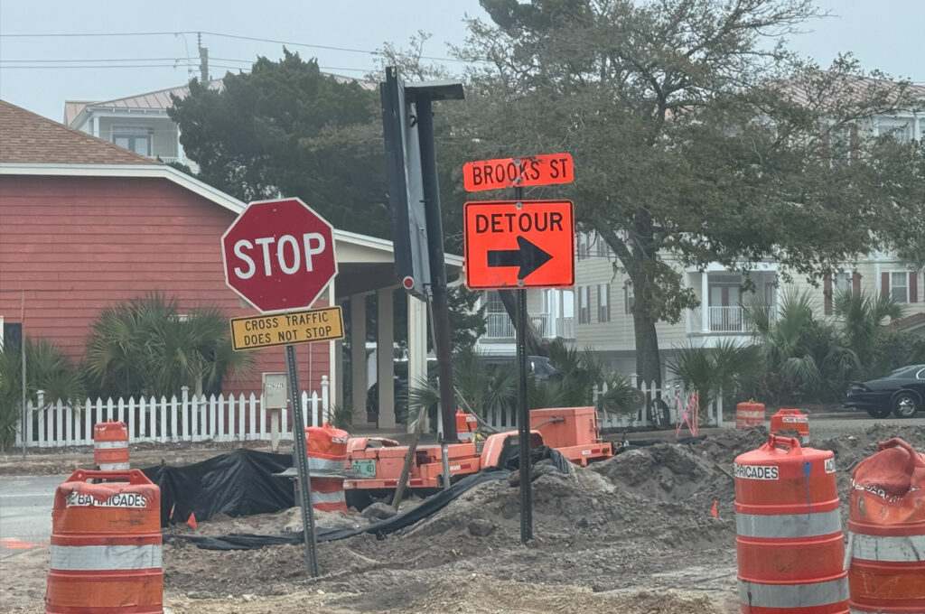
The Business Access Road, located beneath Brooks Bridge on Okaloosa Island, will be temporarily closed between the Adventure Marina and the Brooks Bridge Marina beginning Monday, April 24.
- This segment of the road will become part of the dedicated work zone for construction of the new Brooks Bridge and will remain closed for the duration of the project.
According to FDOT, U.S. 98 eastbound drivers will be detoured for access to the Brooks Bridge Marina and Alvin’s Island, located on the Business Access Road (north side of U.S. 98).
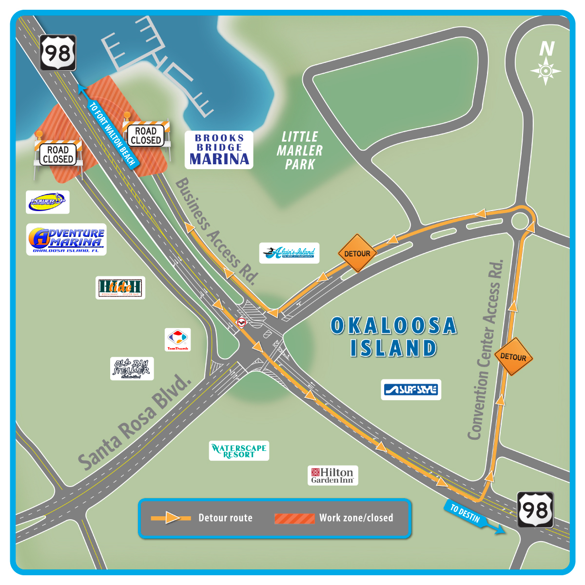
These drivers will continue through the Santa Rosa Boulevard intersection, turn left onto the Convention Center Access Road (located to the west of the Destin-Fort Walton Beach Convention Center), proceed to the roundabout to exit onto Santa Rosa Boulevard, then to the Business Access Road.
- Detour signage will be in place to help direct drivers.
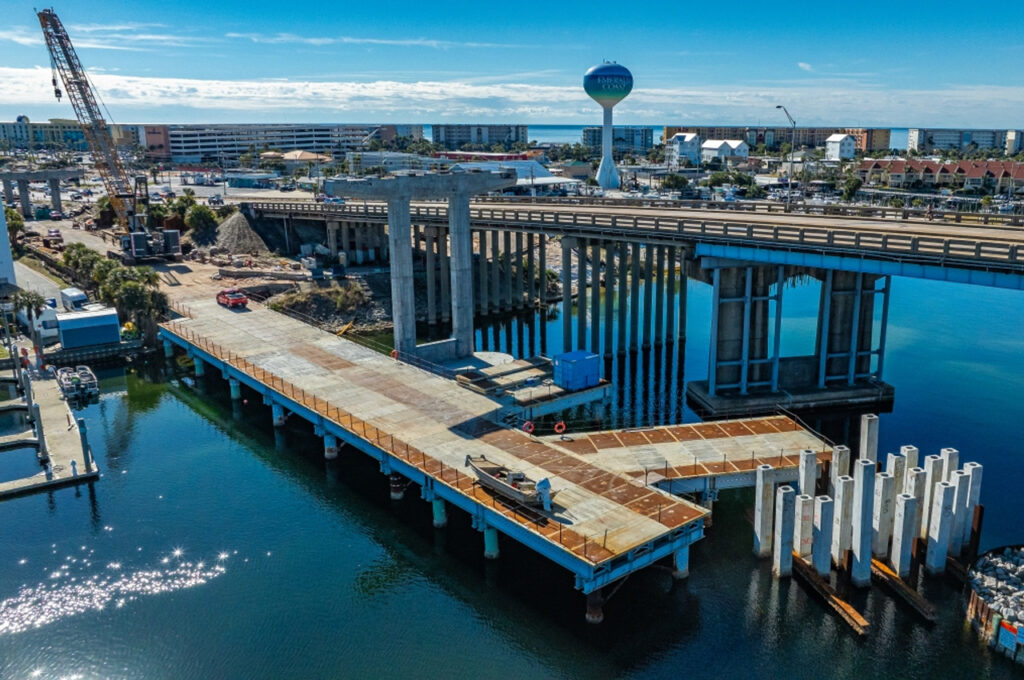
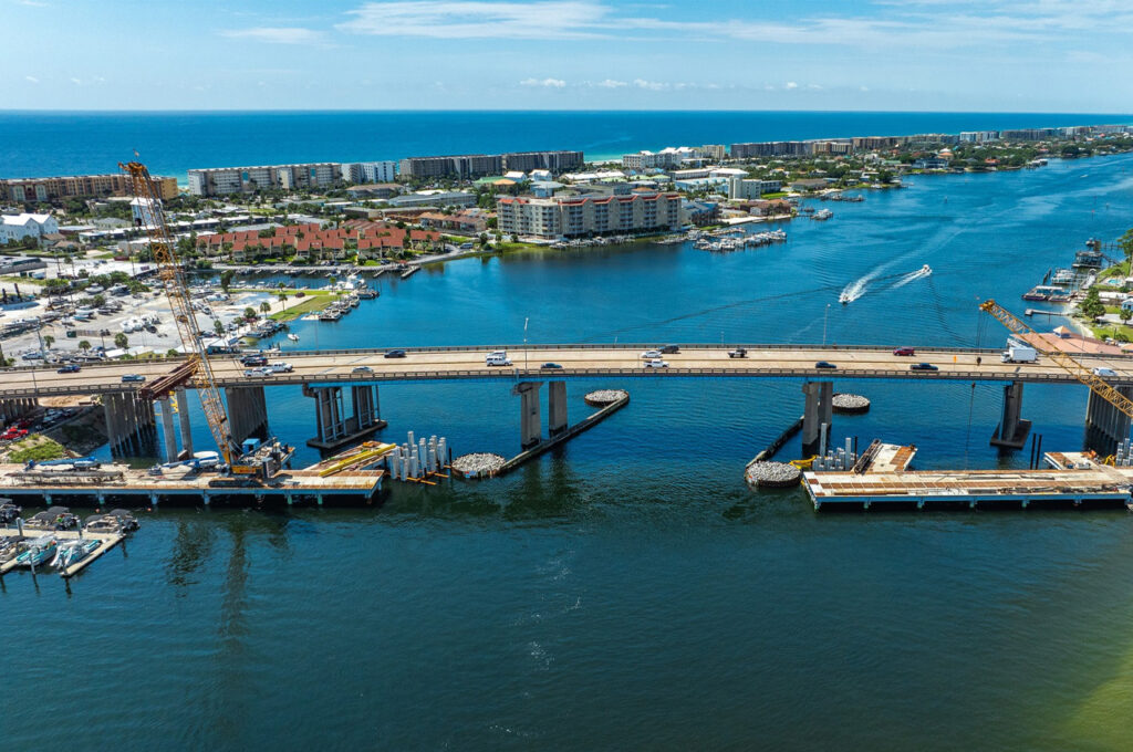
The $171-million Brooks Bridge replacement project includes constructing two new, parallel bridges that will increase capacity to six travel lanes from the current four-lane bridge that opened in 1966. Preliminary construction activities are now underway with project completion estimated for mid-2027.
All activities are weather-dependent and may be delayed or rescheduled in the event of inclement weather. Drivers are reminded to use caution, especially at night, when traveling through a work zone and to watch for construction workers and equipment entering and exiting the roadway.