The Okaloosa County School District has announced that schools will be closed on Tuesday, April 5th, due to potentially severe weather.
- All before and after school activities, including extracurricular activities, daycare, and tutoring, are canceled as well.
“It has undoubtedly been a challenging month of weather in Northwest Florida,” said Superintendent Marcus Chambers. “Adjustments to the school day due to severe weather disrupt our daily routines, and it would be expected for “weather fatigue” to set in. However, the alternative places too much risk on our students and staff.”
School will resume on Wednesday.
A strong line of storms will move through the area on Tuesday from West to East with the greatest threat between 9AM and 3PM, according to Okaloosa Public Safety Director Patrick Maddox.
- This places the entire forecast area in the Enhanced (orange) Risk category.
“Some discrete cells are possible ahead of the main line of storms in this scenario, with the main squall line arriving somewhere in the middle or late end of that window,” said Maddox. “This system will be a significant weather threat with 70+ mph winds and fast-moving tornadoes possible both within the squall line and embedded within the discrete cells.”
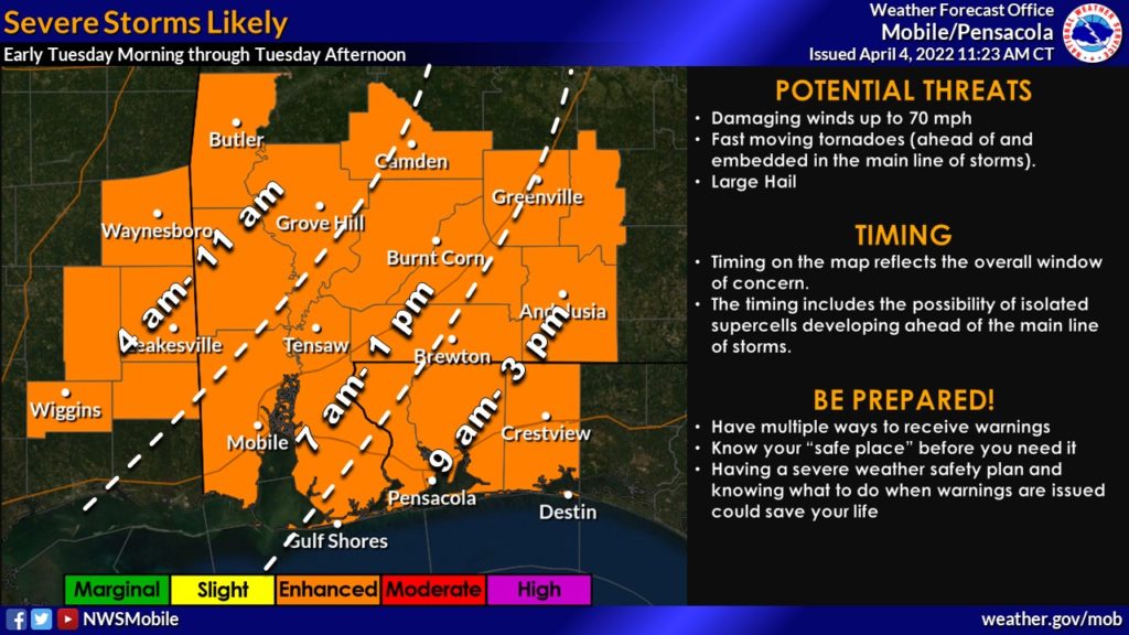
Rainfall in the 1-3” range with locally higher amounts possible in areas where storms travel repeatedly.
According to Maddox, after the line passes, some weaker storms are possible in the wake of the system, followed by a break Tuesday night and Wednesday morning.
Rip current and high surf threats will increase beginning Monday evening and persist for much of the week.
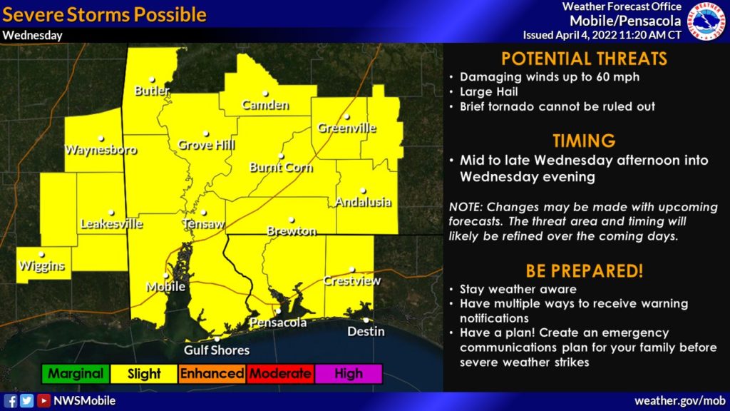
For Wednesday, a more isolated/scattered severe storm threat is forecast to occur in our area Wednesday afternoon and evening, with the forecast area currently in the Slight (yellow) Risk category.
- This will be more of a damaging wind and large hail threat.
“Although a brief tornado can’t be ruled out, the tornado threat for Tuesday is greater,” added Maddox. “These scattered storms will persist through the evening hours ahead of a cold front which will shut the system down in the evening time and provide a few days of drier weather.”