
Okaloosa County can continue to expect an “unsettled weather pattern” through much of this week as several rounds of storms move across the region. According to Okaloosa Public Safety Director Patrick Maddox, a few severe storms will be possible across portions of our area today with potential for more significant severe thunderstorm development on Wednesday.
- Heat will also build across the region late this week and this weekend. We can also expect a HIGH risk of rip currents along area beaches Thursday and Friday and potentially continuing into the weekend.
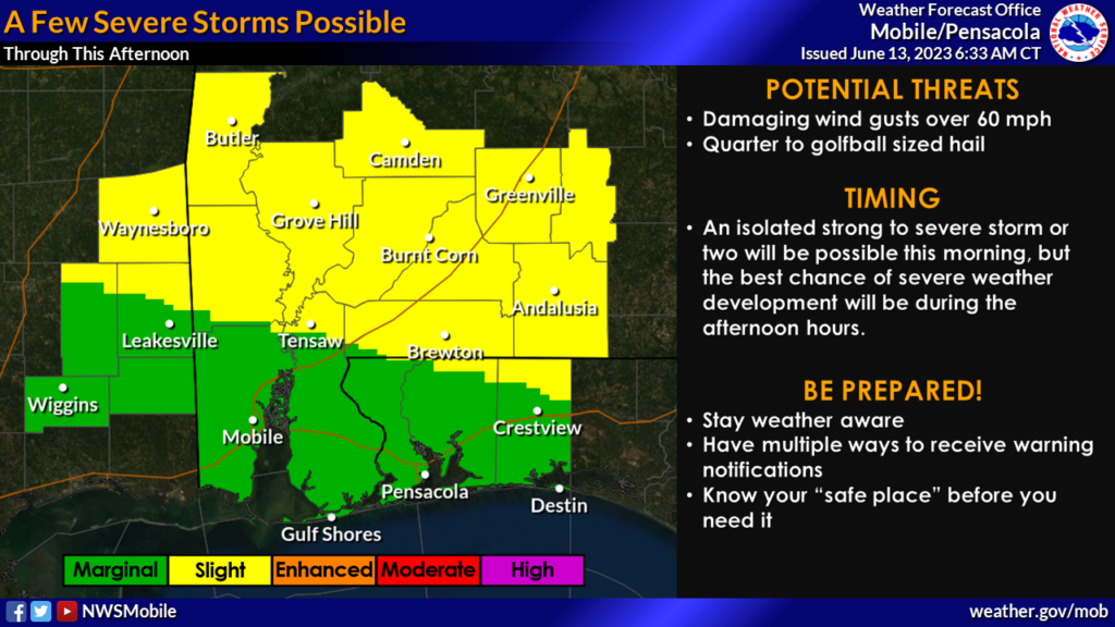
Today, June 13, there is a potential for a few severe storms, particularly in the interior portions of southeast Mississippi and southwest Alabama. Damaging winds of up to 60 mph and hail ranging from quarter to golf ball size are the primary concerns, according to Maddox.
- While isolated strong to severe storms could occur in the morning, the afternoon hours hold the greatest likelihood for severe weather development. The entire area falls under a SLIGHT Risk (Level 2 of 5) for severe weather, with the highest potential across the interior portions of southeast Mississippi and southwest Alabama.
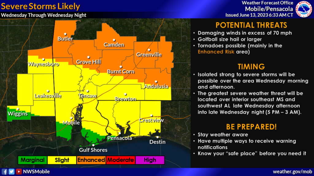
Looking ahead to Wednesday, severe storms are expected to be more widespread, especially in the interior regions of southeast Mississippi and southwest Alabama. Late Wednesday afternoon into Wednesday night, Maddox anticipates damaging winds exceeding 70 mph and the possibility of golf ball-sized hail or larger. Tornadoes may also be a threat, primarily within the ENHANCED RISK area.
While isolated strong to severe storms are possible throughout the morning and afternoon, the most severe weather activity is expected from late Wednesday afternoon into Wednesday night, between 5 PM and 3 AM (timing subject to adjustment).
- The ENHANCED Risk (Level 3 of 5) for severe storms stretches across areas north of a Waynesboro, MS, to Andalusia, AL line. The remainder of the area falls under a SLIGHT Risk (Level 2 of 5).
Apart from the storm potential, Okaloosa County residents should prepare for an increase in heat-related concerns as we progress through the week. High temperatures will climb into the 90s, accompanied by maximum heat indices ranging from 102 to 107 degrees, according to Maddox. Some areas may even experience peak heating with heat indices reaching around 110 degrees.
Additionally, a HIGH risk of rip currents is anticipated along our area beaches from Thursday through Friday, with the potential for this risk to extend into the weekend.
- Beachgoers are advised to exercise caution and heed all warnings issued by local authorities.