The Florida Department of Transportation (FDOT) will hold a hybrid public alternatives meeting Tuesday, Feb. 20 concerning the U.S. 98 “Around the Mound” Project Development and Environment (PD&E) Study.
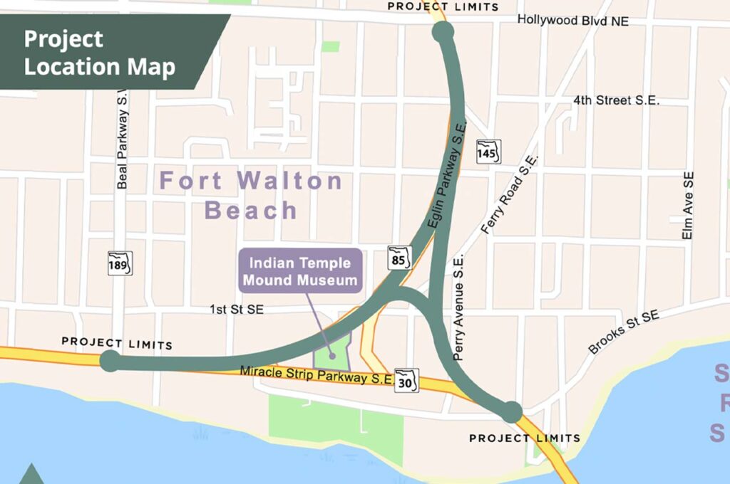
- The project limits cover State Road 30 (U.S. 98/Miracle Strip Parkway) from S.R. 189 (Beal Parkway) to the west end of the Brooks Bridge in Okaloosa County.
The hybrid meeting will run 5:30-6:30 p.m. Citizens can attend virtually at www.nwflroads.com/virtualmeetings. Those unable to participate online can attend in person at the Destin-Fort Walton Beach Convention Center, 1250 Miracle Strip Parkway SE. Preregistration is required for virtual attendance and encouraged for in-person.
- Registration details are at www.nwflroads.com/virtualmeetings.
The purpose of the study is to address existing and future traffic capacity and safety issues on U.S. 98 as well as high volumes of regional and commuter traffic through downtown Fort Walton Beach.
The PD&E study aligns with recommendations from the 2019 City of Fort Walton Beach Downtown Master Plan and the 2020 FDOT Feasibility Study, according to FDOT.
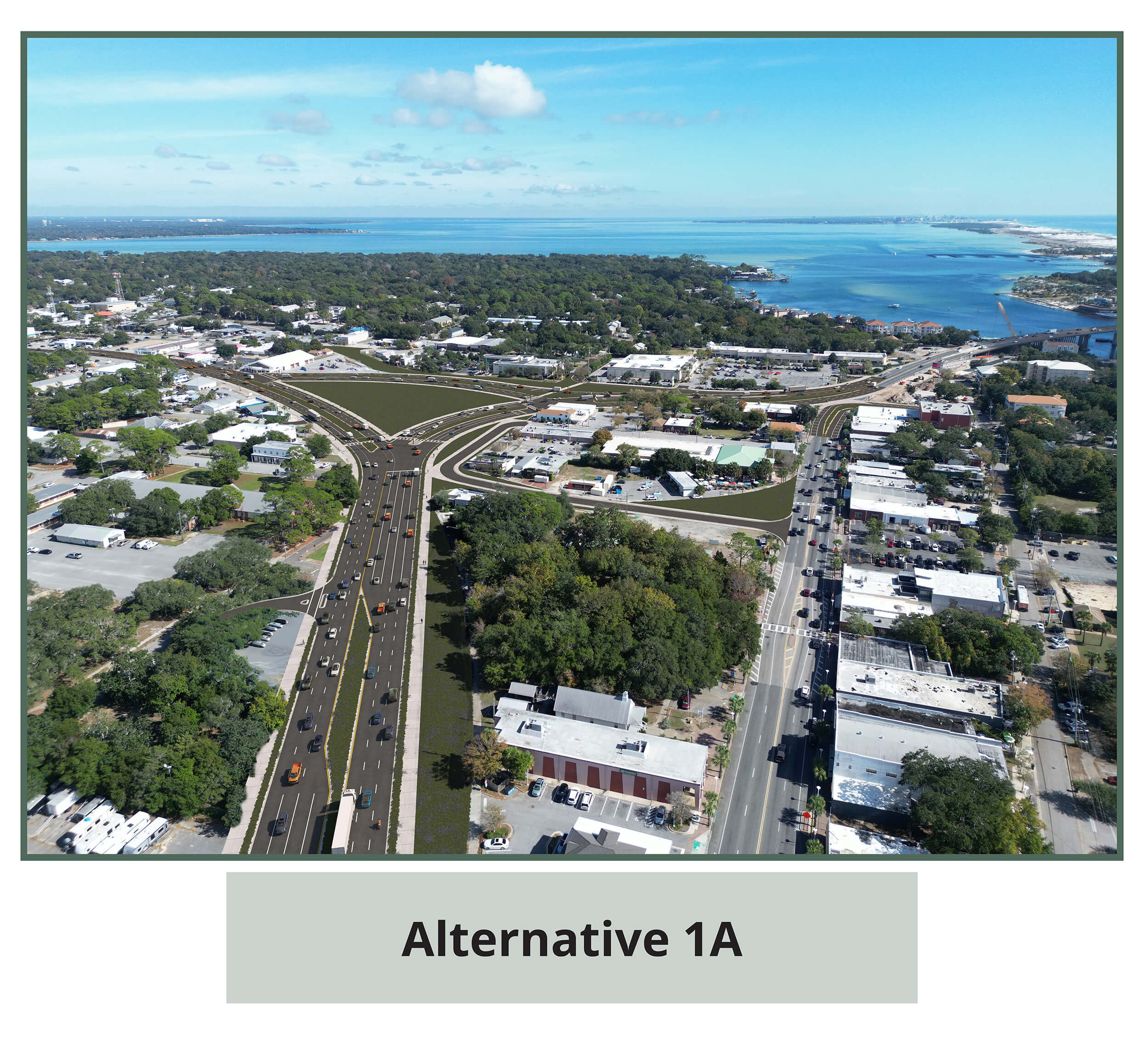
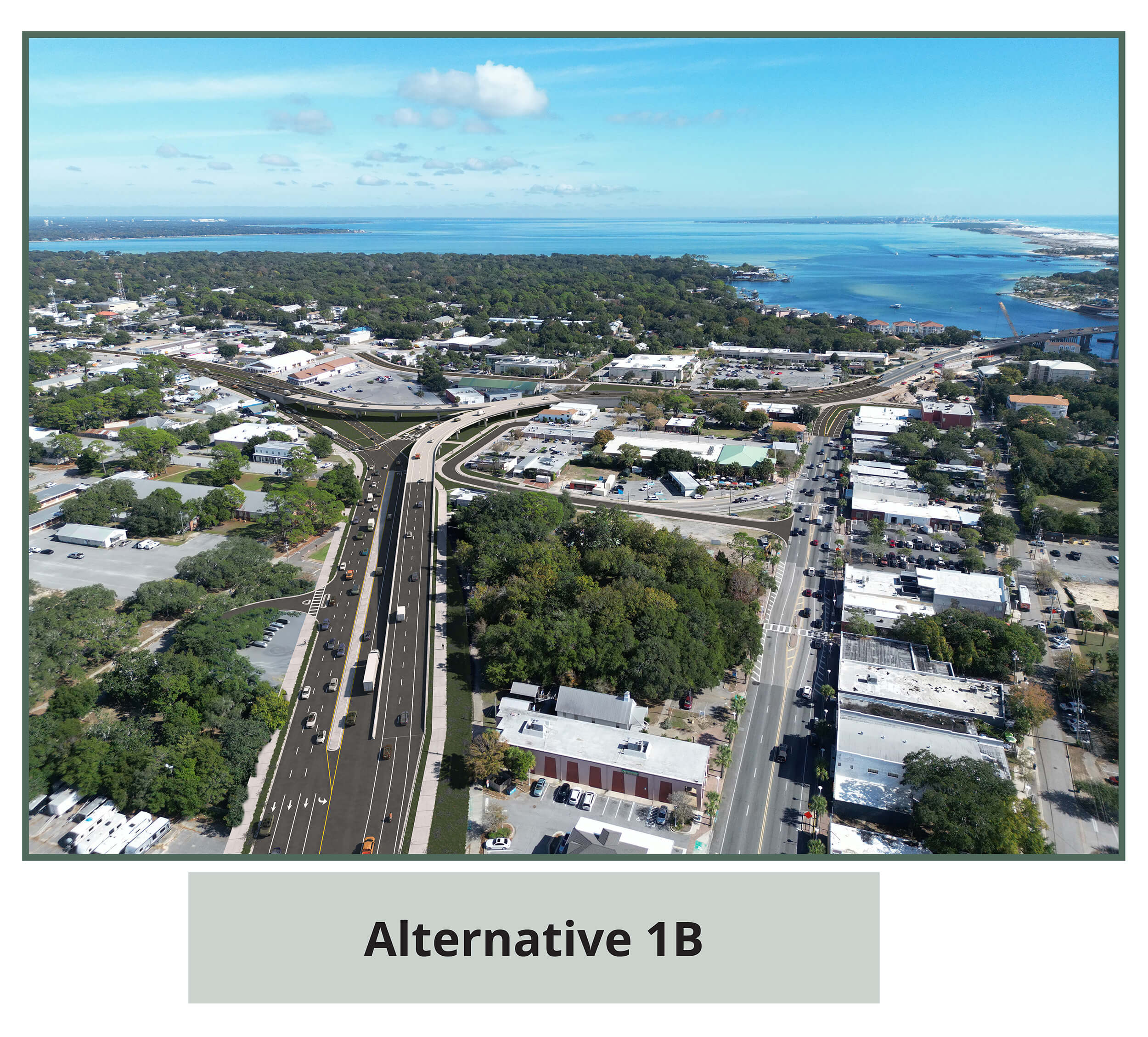
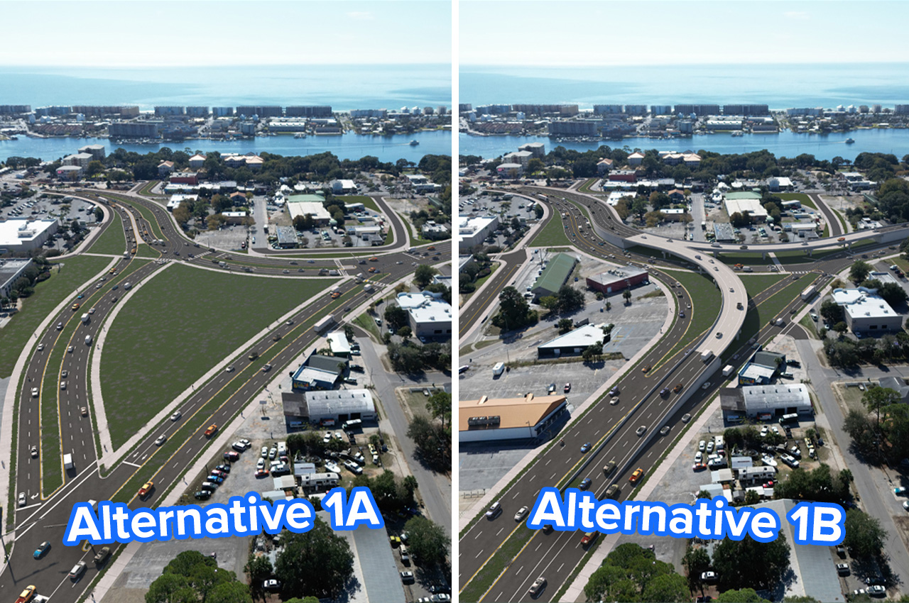
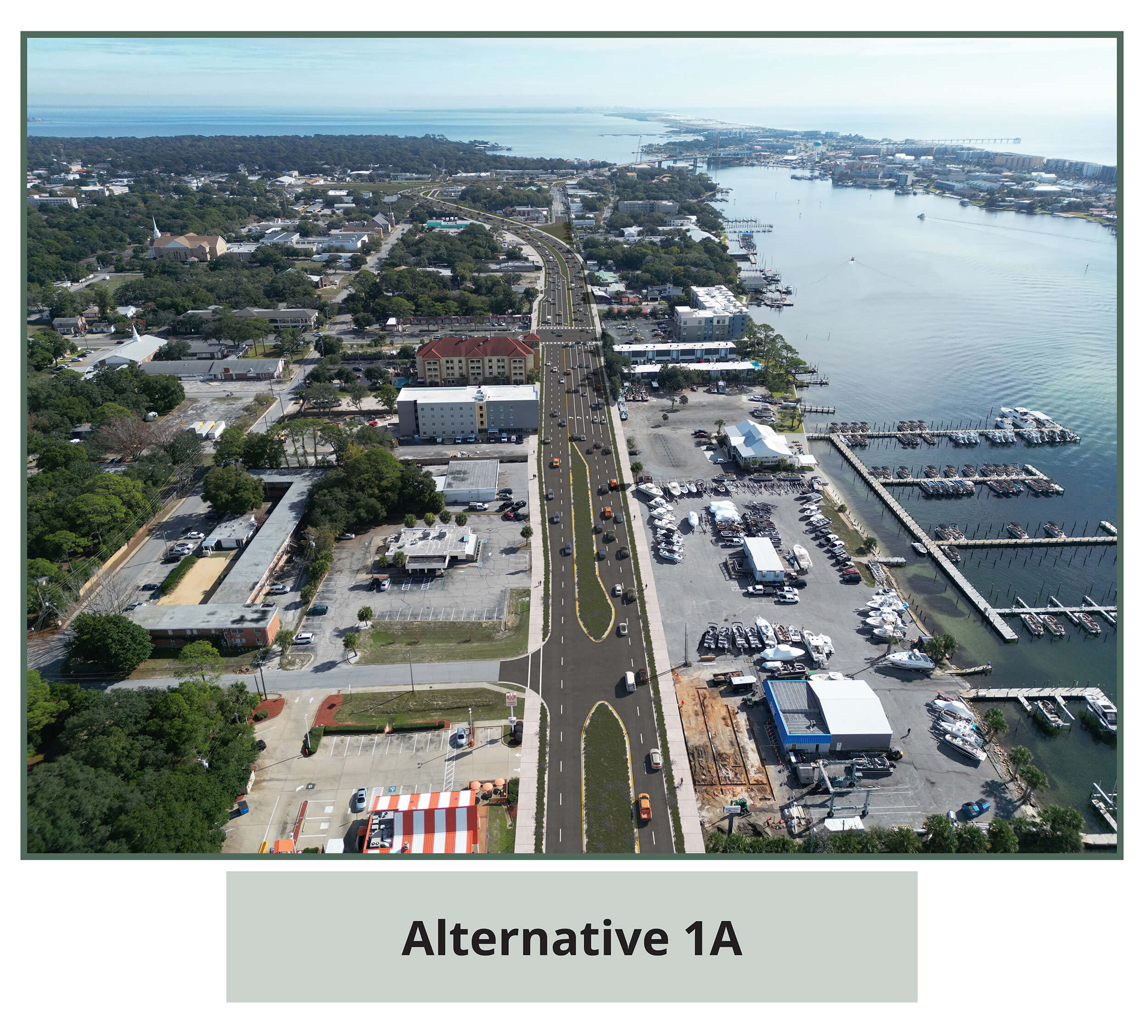
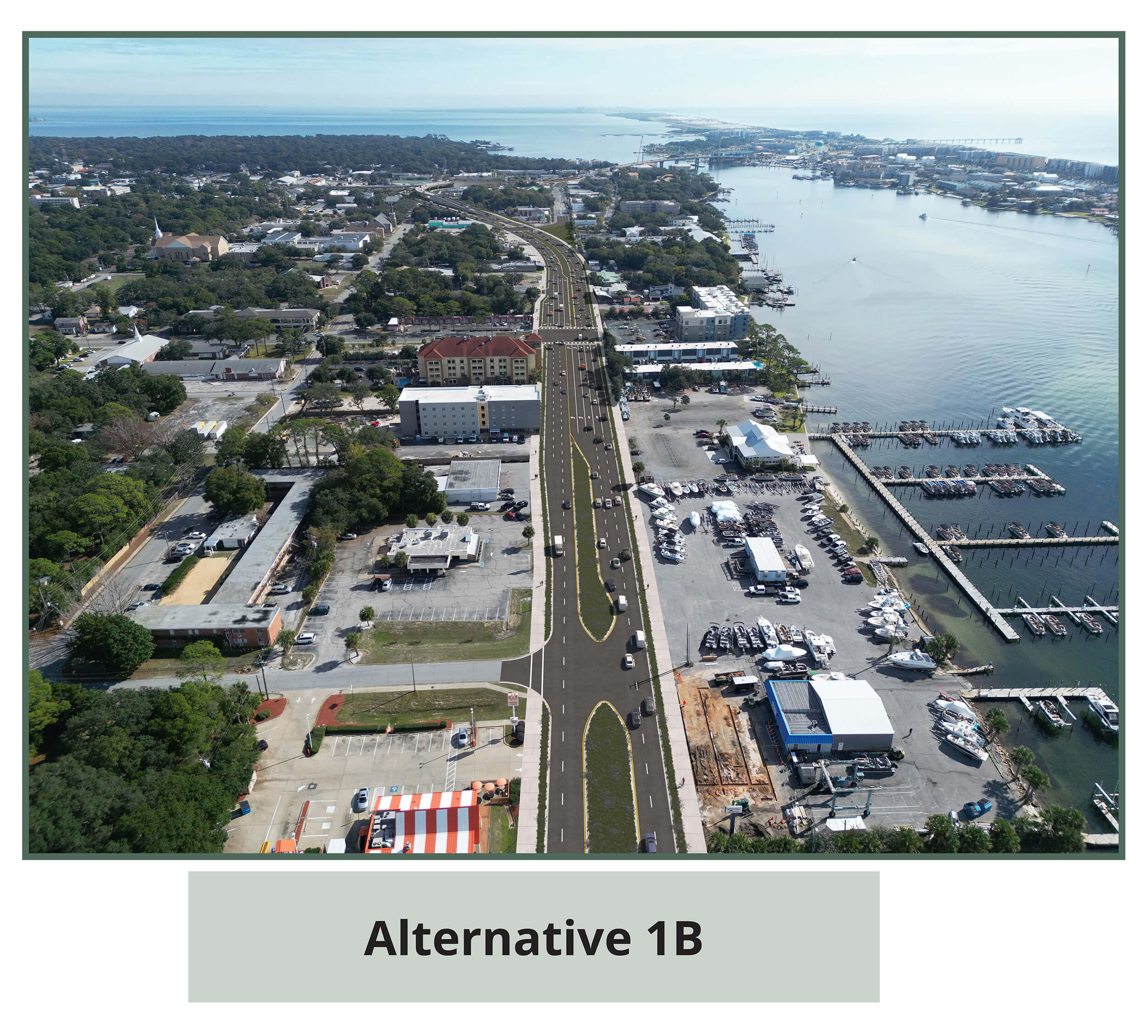
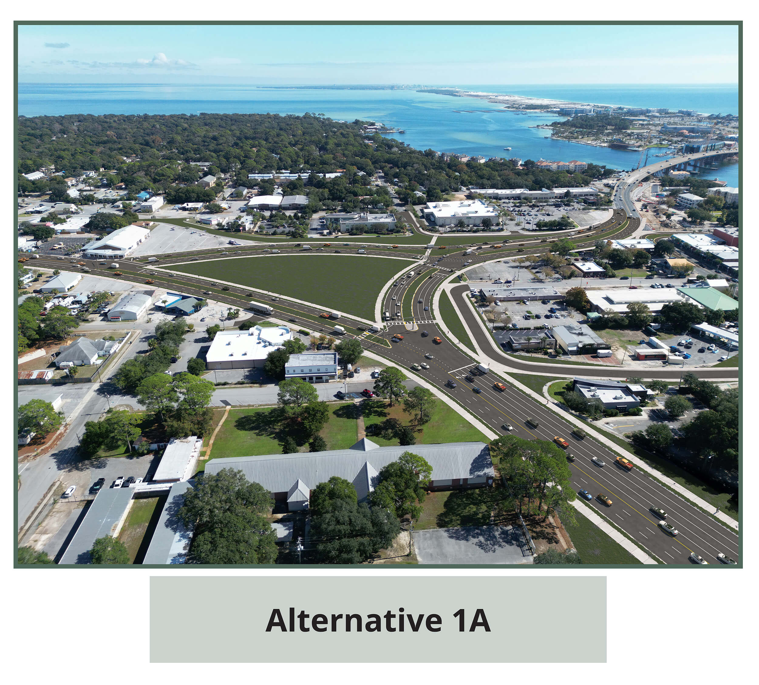
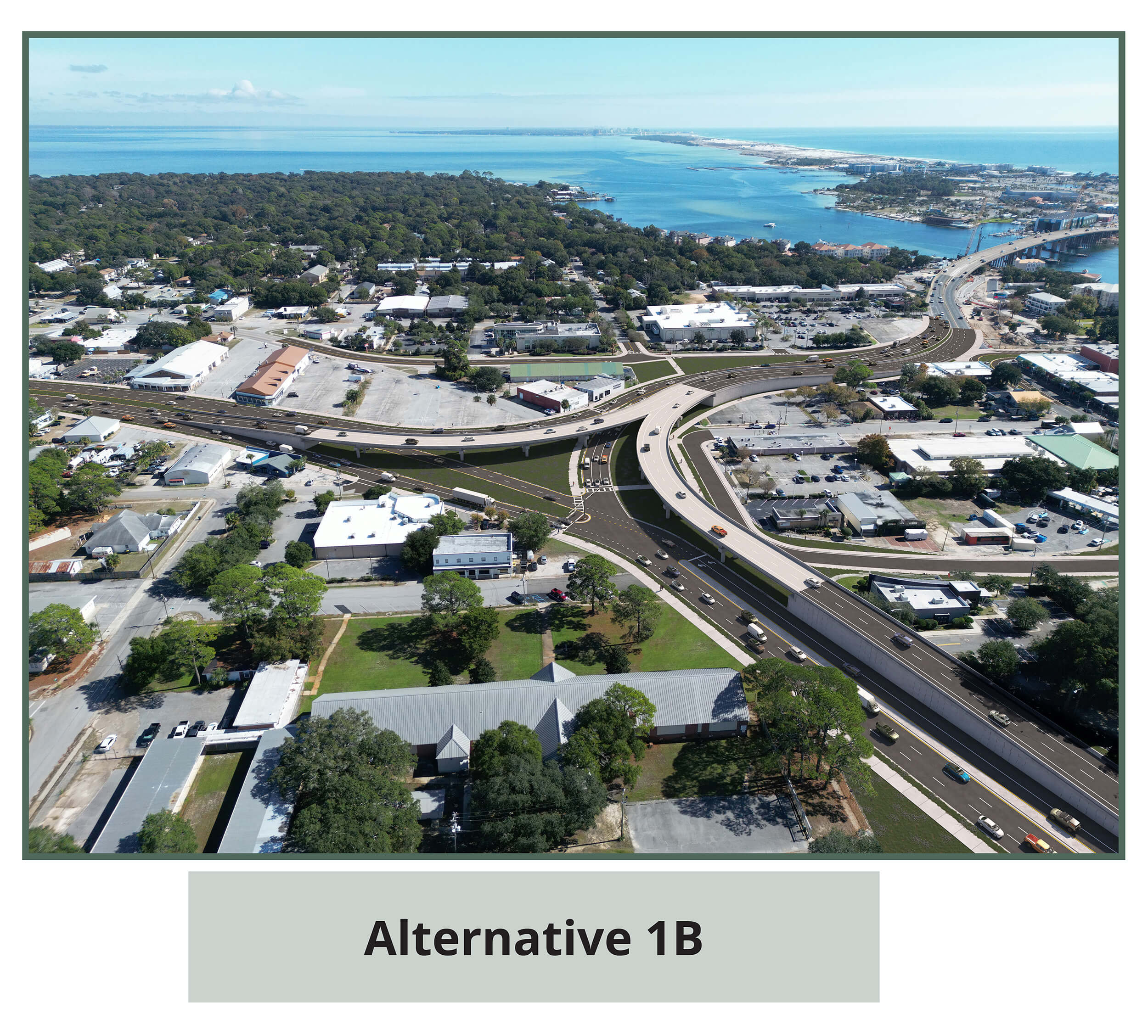
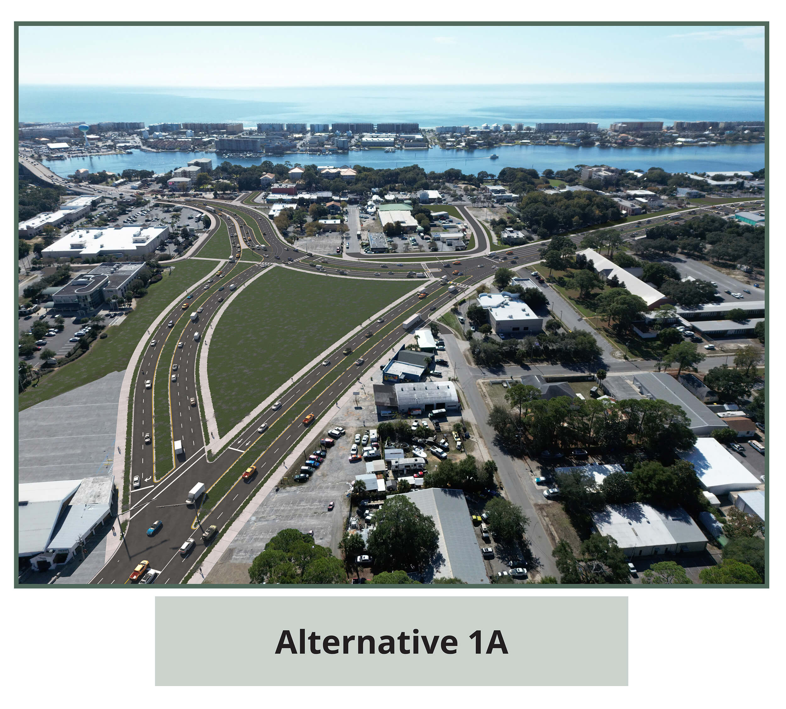
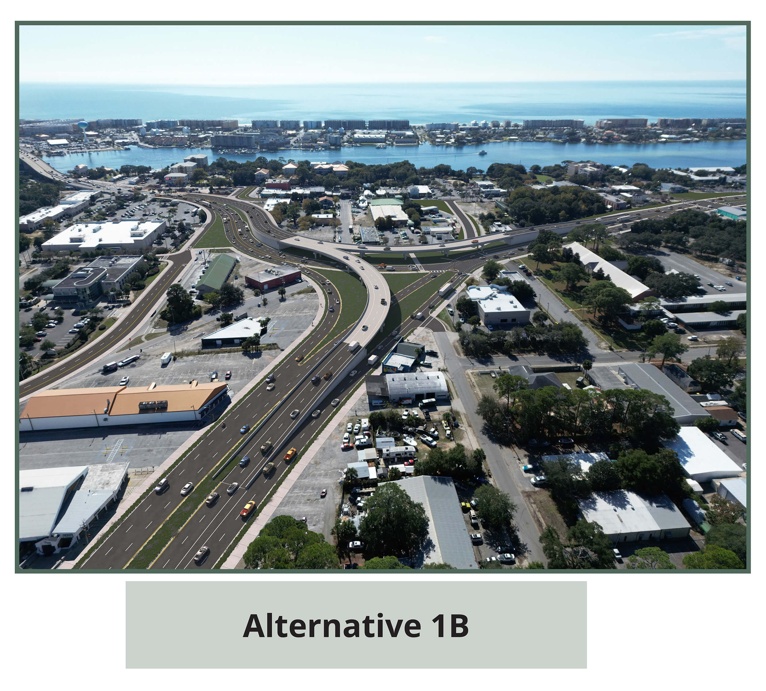
Two build alternatives will be presented: Alternative 1A (At-Grade) and Alternative 1B (Grade-Separated). A No-Build Alternative is also under consideration.
- Access management changes will be required, along with right-of-way acquisition resulting in some business and residential relocations. Future phases of right-of-way, design and construction are currently unfunded in FDOT’s five-year work program.
Those wishing to comment can do so at the meeting or by contacting the project manager. The deadline for official comment submissions is Friday, March 1, 2024.
A PD&E Study is the formal process that develops and compares alternatives to determine a preferred action that meets project goals while minimizing impact to social, natural and physical environments, per the National Environmental Policy Act’s public engagement requirements.
The purpose of this project is to increase the capacity of U.S. 98 to accommodate current and future traffic and reduce downtown Fort Walton Beach passthrough volumes by regional and commuter vehicles.
20 Responses
Alternative 1 B would be the best option.
I’d say 1B. Flyover and avoid a traffic light. Also I don’t know why the old “Landmark” property was not purchased by FDOT or FWB when it was last up for sale. It would have prevented the relocation of Beach Liquors
1B is a better option. Then we just have to make downtown a destination place for locals. More outdoor eating and entertainment.
Looks like either would make traffic less of an issue for residents and tourist traveling around Fort Walton Beach. I think and like 1B since it would be the least footprint and allow for some businesses to remain.
I was going to say that 1B would be the more expensive option because of the elevated roadways, but I am no longer sure because with 1B you have fewer business/buildings to have to buy then raze.
Don’t think I like the 1B option. It puts old downtown underneath and in the shadows of a tangle of overpasses. Reminds me of the raised highways on the way into New Orleans. All those areas beneath the overpasses become subterranean shadowy netherworlds. With the highways on the same level, there’s more open visibility and opportunity for landscaping the open spaces. Let’s more light in. So far at least — until I know more — I am in favor of 1A.
I totally agree with you Jim. The first option is so much more attractive. I feel we would lose the charm of the downtown area with the overpass, it would be just too intrusive and could very well end up looking like the present area underneath the Brooks Bridge.
1B seems more pedestrian friendly. Let’s incorporate a skatepark under one of those over passes!
I like 1A better. It is aestechically pleasing and keeps it more of a small town feel and less urban. It would still encourage people to visit downstown area instead of just passing through. I am sure 1B would be more costly.
1A is more aestetically pleasing and feels less urban. Like it best. I think 1B would encourage people to blow past downtown rather than stop to shop or eat dinner.
Definitely like plan 1a better. Plan 1b is too intrusive and would take away from the small town feel of our downtown area. I believe there will be more information on Fdot site tomorrow.
It says a no-build alternative is also being considered, but apparently not seriously enough to be discussed at this meeting. Let’s get all ideas out for public review. Show it along with the two “build” alternatives so folks can see how it affects traffic flow. It seems like there is already a mindset that the solution is to “teardown and build”.
I find it hard to see from the pictures how anyone from northeast FWB or on Okaloosa Island will be able to find their way to the downtown businesses, including the library and the Landing. Any solution should indicate local traffic patterns to the newly isolated area under each option.
For those concerned about losing “small town feel”, know that any kind of faster traffic pattern will result in that. It just comes with the territory. But cars jammed up on 98 trying to get to the beaches doesn’t feel very small town, either.
I would choose no build, until a better traffic flow idea arises. Definitely against multi-level for the reasons stated above. One-way options and roundabouts should be seriously
considered.
I like 1B. Option 1A adds two stop lights to get from Eglin Pkwy to the Brooks bridge, which will cause traffic problems. With option 1B, there are no stop lights and the traffic flows freely from Eglin Pkwy to the bridge.
1A I don’t know why a no build option would still be out there. If the dream of around the mound and a nice walkable downtown is to be a reality like in Sanford I think 1A is the best option. Less concrete and more greenspace. Plus there is the upkeep of an overpass to consider.
Both have pros and cons. Traffic flow would obviously be best with 1B. The less traffic lights the better I think but overpasses are going to accumulate trash and other undesirable problems. I think there needs to be more detail on downtown access and parking areas.
Anybody remember the Embarcadero, HWY 101, through the city of San Francisco? The overpass would become a haven for homeless and as mentioned above cast shadows on downtown Fort Walton and make it a not so desirable place to be.
1b is the best by far. No question. 1a is only marginally better than what we have now.
For 1b plan, need to add a turn into downtown at the new light where Eglin Pkwy southbound merges into Miracle Strip W. (I.e. the turn into downtown would go under the new overpass).
Also, going to need a parking deck somewhere.
Traffic signals have a definite limit to how many cars an hour can pass under them. The signal system downtown has been beyond capacity since 1990. To increase capacity additional lanes are required. A casual estimate at the time was 8 lanes basically bulldozing downtown. If you look at the larger area map there is an 4 lanes east-west highway, and a 6 lanes north-south all merging into a 4 lane bridge. So for a road problem the choices are widen, go around, over, under or do nothing. Fort Walton Beach proposed the first Around the Mound study in 1997 recognizing the traffic back-ups were affecting the area. The proposals were limited as the bridge was not scheduled for replacement. With the current bridge replacement and the elimination of of the traffic signal at Santa Rosa BLVD allows a new study. US 98 will be basically free flowing till Destin. The signals at Santa Rosa and Perry were the weak point as the amount of traffic from the side roads demanded the main road stop to let the side traffic enter. The traffic blockages affected the entire area. As US 98 backs ups for miles, modern traffic maps like Google or Waze rerouted to local roads. Hollywood it the first reroute so during peak hours it backs up impacting the adjacent roads and neighborhoods. Of course on the Island the there is no alternate so you have to sit and wait. Alternate 1B separates the majority N-S and E-W traffic to flow without traffic signals. The enemy of perfection is good (or acceptable). In this case, Alternate 1B provides acceptable choice to bulldozing everything.
1B…………….Let FWB grow.