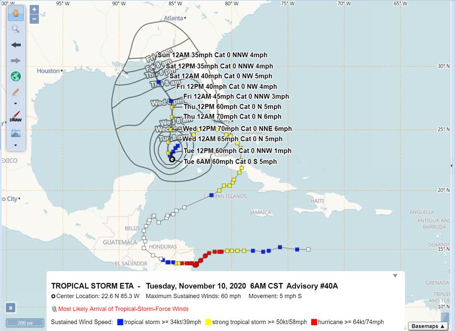
While there is a lot of uncertainty, there is one thing we do know about Tropical Storm Eta right now: the storm currently has 60mph max sustained winds as it moves through the Gulf of Mexico.
The National Weather Service reports that Eta is forecast to move slowly northward across the eastern Gulf through the end of the week. The latest forecast track from the National Hurricane Center has shifted slightly more to the west early this morning, but shows a continued weakening trend as Eta approaches the Gulf Coast this weekend.
“When the NHC alluded to big changes coming in the forecast cone, they weren’t kidding, and I think there’s more changes to come,” said Patrick Maddox, Okaloosa County Director of Public Safety, on Tuesday morning.
“Confidence in this track is very, very low,” said Maddox. “Believe it or not, even with the storm passing much closer to us in this scenario, our local projected impacts haven’t changed in any measurable fashion with the system forecast to be so weak upon landfall. That being said, I’m watching it like a hawk because I’ve got the same low confidence in it as the NHC does.
According to Maddox, the NHC is “pretty comfortable” with the system weakening, but the exact intensity and track is up in the air.
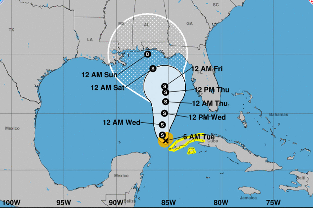
Eta will produce a continued high risk of rip currents along area beaches through at least Saturday. Hazardous marine conditions will also be possible late this week as there is potential for increasing winds and building seas offshore with Eta’s approach. NWS reports that confidence on any other impacts remains very low at this time as they will be dependent on the eventual track of Eta.
“It depends on how much Eta can get its act together over the next 48 hours, after which time dry air and shear should begin winning the fight and begin weakening the system,” continued Maddox. “Earliest reasonable arrival of Tropical Storm winds is Thursday morning, most likely arrival on Friday mid-day, if they make it this far.”