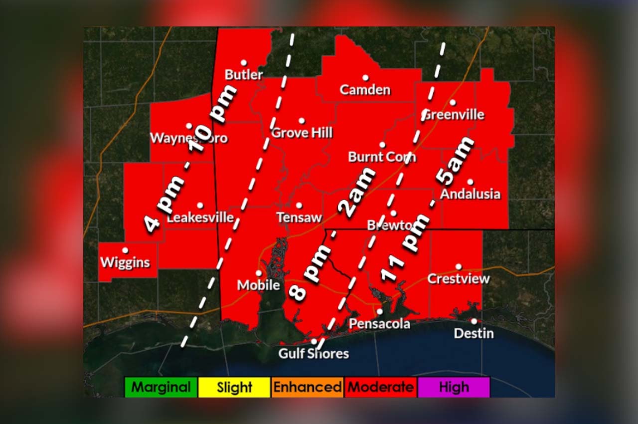
Severe thunderstorms capable of producing strong tornadoes and intense damaging straight line winds will become possible across Northwest Florida on Wednesday evening into the overnight hours.
“Ahead of the storms, we have a very windy day on tap for Wednesday with 30-40 mph gusts being possible throughout the day,” said Meteorologist Spinks Megginson.
According to RedZone Weather, 6PM Wednesday to 6AM Thursday remains the 12 hour window when severe storms are most likely to happen locally, with 9PM to 3AM being the “core window.”
- The current expectation is that the system will be clear of our area between 4-5AM Thursday, but that could always change.
The Mobile National Weather Service indicates that this event could have the potential for destructive straight line winds. “80 mph winds is 80 mph and can easily produce damage comparable to a tornado,” they wrote.
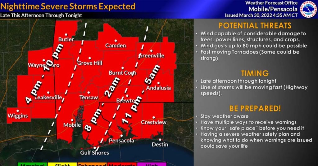
As of 11am on Wednesday, Okaloosa Public Safety Director Patrick Maddox said that although the timing has slowed a little on arrival of the storm line (12AM instead of 11PM), the exit time of 5AM still holds due to the fast-moving nature of this system.
“The weather expected to impact our area during this event will be dangerous, placing the entire forecast area in the “Moderate Risk” category,” he said. “This will be a fast moving system with the capability of delivering gusts to 80MPH within stronger thunderstorms, and producing strong, fast-moving rain-wrapped tornadoes with little time to react.”
According to Maddox, some of these strong tornadoes could be long-track, remaining on the ground for extended periods.
- “Ahead of the main storm line we are not expecting wide-spread supercell development, but strong southerly winds of 20-30MPH, gusts to 55MPH throughout this afternoon are likely,” he said. “We are already seeing the winds increase and are flying double red flags at the beach.”
Some minor coastal flooding of 1-2 feet is possible with rain totals in the 1-3” range likely. Maddox says that heavy downpours are possible, but the system will be moving so quickly that flash flood threats are limited.
“The current expectation is that the system will be clear of our area between around 5AM Thursday, but there is always room for adjustment there based upon exact storm evolution,” he said.